Listed below are my hiking pearls, each offering something unique. I’ll do my best to describe them and to point out their outstanding qualities. See for yourself and let me know what you think. Maybe you’ll see them differently or will find something special I’ve missed.
The Bonneville Scenic Trail: Salt Lake Segment (E)
The Bonneville Scenic Trail is an amazing work of passion, started nearly 20 years ago by the Bonneville Trail Committee. It’s taken years to piece the trail together—many public hearings, private and public financial donations; battles over rights of way with a few resistant homeowners who see the foothills as their very own. Eventually, it is dreamed, the trail will connect the entire Wasatch Front from Box Elder to Utah counties.
This place is special because the trail is designed as an urban interface with the Wasatch Mountains. By combining city and mountain, the trail signifies the best features of our community’s stunning geography.
| Hike Legend: E—Easy: Doable for most any person of any age; good for families. M—Moderate: Some physical condition necessary; altitude adjustments. D—Difficult: Longer hike, strong physical condition necessary, scrambling and exposure involved. |
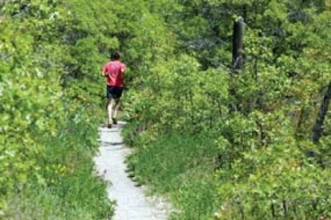
Watch out for mountain bikes. Bonneville Trail is a mixed-use outdoors paradise, and on a good day, everyone and her dog will be there—literally. It’s a biker’s heaven and some of the “studs” are training for the next race. You have the right-of-way but don’t believe it for one minute. I suggest stepping off the trail because you won’t win the collision. A friendly “hi” will suggest you are human. If your dog is along, watch the leash.
An amazing variation (M)
Directly east of the Huntsman Corp. headquarters building in the U’s Research Park, a trail leads east to the top of Wire Peak, another fine hike, familiar to many. Hike the trail for a quarter mile to where a couple of switchbacks take you to the Red Butte Peak ridge on your left. Hike to “The Furniture” high on the ridge. Over the years, clever ones have arranged flat sandstone into a complete living room of “easy chairs” and “couches.” My wife and I go there to celebrate our wedding anniversary with a bottle of wine and some good cheese while watching the sun sink in the west. A most romantic spot provided there are no crowds.
City Creek (E)
I find this hike as spectacular as any you find in America. Why? Because how many New Yorkers or Washington, D.C.ers can walk or jog just over a mile from a downtown hotel and be in a wonderful mountain canyon? We have it all the time! You’ll find a gate at the bottom of the canyon just north of the U turn. Hikers are welcome every day on the pavement into the canyon and bicyclists on odd days during the high season (Memorial Day through Labor Day). Watch for traffic on even days and for service vehicles every day if you are hiking the asphalt. Bikers descend very fast, so watch out and stick to the south side of the road—to your right as you ascend.
Better yet, forget the asphalt and the traffic. Enter a trail that parallels the road on the north—to your left ascending. You can enter this trail at the U turn below the gate or just up the canyon above the gate to your left. Toilets and water fountains are found along the asphalt road and the trail comes close to them.
It’s more than six miles to Rotary Glen at the top of the trail. The glen is lovely anytime but especially when the afternoon light blinks through the trees as the creek gurgles nearby.
Donut Falls (E)
A short hike with a spectacular and unique waterfall awaits you. It’s a wonderful stroll for the whole family. After the falls, on the way down, take a picnic to share near the stream.
Drive 8.3 miles up Big Cottonwood Canyon to an obvious parking lot—Mill Fork D, South Fork—where the road flattens out. Turn right through the gate and drive a little more than one mile to a dirt parking lot with a pit toilet and a trailhead. Hike to the falls about one-half mile. The route takes you up the bottom of Cardiff Canyon, one of the mining centers of the Wasatch Range in the late 1800s. At one time, several thousand miners lived in the canyon.
If you have time, backtrack from the falls to a trail junction that will take you to a hiking road up Cardiff Canyon to the Cardiff Mine (2 miles; 1,000 vertical feet). The mine ruins will give you a distinct feeling for the large scale industry that mining was in the 19th century.
Grandeur Peak (M)
A must-do hike for the view from the summit alone. You’ll feel as if you’ve been crowned emperor of the Wasatch Front as you sit high on your seat of grandeur overlooking the Salt Lake Valley. Go ahead, conduct traffic on Interstate 15, decide where the open space should be, command the little ant-people below to be good and follow your commands. You are in charge of the Wasatch.
There are two ways to climb Grandeur. The first is tougher and more direct, but has the advantage of offering a view of your kingdom the entire way. Go to the Eastwood Elementary School where 3300 South tops out at the east. Turn left and drive north one-half mile to the small park where the Parley’s bike way crossing begins. Head straight up the ridge east to the top. It’s that simple, but strenuous (2 miles; 3,300 vertical feet).
The second way is more indirect but considerably easier. Go to the Church Fork Picnic Area in Mill Creek Canyon. Drive to the top and park. A trailhead begins your hike to the north. You’ll climb out of the side canyon, up some switchbacks and end up on the ridge above Parley’s Canyon. Continue on to the west to a series of switchbacks to the summit (3.1 miles; 3,060 vertical feet).
Mount Timpanogas, North Face (D)
Here’s what you have been waiting for. The pièce de résistance. I’ve hiked everywhere in Utah, and in every season. This is the best hike in the state, bar none. I call it the Bestor Tester. Utah composer and musician Kurt Bestor is a serious mountain scrambler and introduced me to this route up Timp several years ago. It is one of the most direct and scenic mountain scambles I’ve done in a lifetime of mountaineering. Warning: The hike does not require ropes, but it is frequently exposed to places you can fall off—a long and rocky way down. But a solid hiker should have no fear.
Drive to the Timpooneke Campground off the Alpine Loop connecting Provo and American Fork Canyons. Drive on a four-wheel-drive road about 2.5 miles to a flat parking area. From there, hike the road just over one-half mile to where the north face of Timp looms above. Take heart and climb straight up the face weaving around small cliff bands to the north summit (10,800 feet) Continue on scrambling this amazing ridge with the yawning valley on your right and the cavernous exposure of the Wasatch Range on your left. After several summits, you will come to where the standard Aspen Grove trail intersects from the east. With a smug look on your face, greet the other pilgrims you’ll meet hiking Timp and take the regular route to the summit. I suggest descending the regular route to Aspen Grove where you have earlier spotted a car. Descending the south ridge to the “glacier” is another recommended descent, but watch it on the snow. Heckuva place to break a hip!
Magnifique!
Ted Wilson is a lifelong mountain climber and backcountry skier who served as Salt Lake City mayor from 1976 to 1986. He is currently executive director of the nonprofit Utah Rivers Council. He is married to City Weekly editor Holly Mullen.